Comprehensive Guide to the United States Interstate Highway System
In this guide you will discover the origins, structure, and importance of the U.S. Interstate Highway System. You will learn how the network evolved, its engineering standards, key routes that shape commerce and culture, the economic impact of this infrastructure, and future planning initiatives that ensure its continued relevance.
Overview of the Interstate Highway System
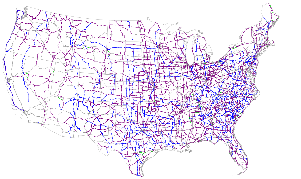
The Interstate Highway System, officially known as the Dwight D. Eisenhower National System of Interstate and Defense Highways, is a network of controlled-access highways that spans the United States. Designed to connect major cities, ports, and military installations, the system facilitates efficient transportation of goods, people, and emergency services across state boundaries. With more than 48,000 miles of roadway, it comprises both Interstate and U.S. Highway corridors, featuring uniform numbering, signage, and safety standards. The system is integrated into regional and local road networks, enabling seamless transitions for travelers and freight operators alike.
Historical Development
The concept of a national highway system emerged in the early 20th century as automobile use surged. The Federal Aid Highway Act of 1921 authorized federal funding for road construction, but it was the 1956 Federal-Aid Highway Act, championed by President Eisenhower, that truly transformed the landscape. The Act allocated $25 billion (equivalent to over $200 billion today) to build a 41,000-mile network of high-speed, long-distance roads. Construction began in 1957 and accelerated during the 1960s and 1970s, with the final leg of the original 41,000 miles completed in 1992. This monumental effort created a backbone that underpins modern commerce and mobility.
Key Features and Design Standards
Interstate highways are engineered to meet stringent standards that prioritize safety, reliability, and speed. Key features include:
- Controlled Access: All entrances and exits are managed via ramps, eliminating at-grade intersections.
- Minimum Lane Width: Standard lane width is 12 feet, with shoulders 10 feet wide for emergency stopping.
- Design Speed: Most sections are designed for a minimum of 70 mph, with some rural stretches permitting speeds up to 80 mph.
- Consistent Signage: The iconic red, white, and blue shield indicates interstate routes, providing clear navigation.
- Durable Pavement: Concrete and asphalt are selected based on traffic volume and climate, ensuring longevity.
These standards result in smoother traffic flow, reduced accident rates, and lower vehicle operating costs.
Major Interstate Routes and Their Significance
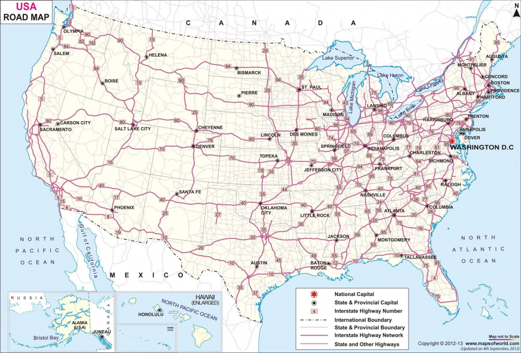
The Interstate system is organized with odd-numbered highways running north-south and even-numbered highways running east-west. Some of the most vital corridors include:
- Interstate 80 (I‑80): Extending from San Francisco, California, to Teaneck, New Jersey, I‑80 connects the West Coast to the Midwest and the Northeast, carrying millions of passengers and freight annually.
- Interstate 95 (I‑95): The main north-south artery along the East Coast, I‑95 links Florida to Maine, facilitating regional tourism and commerce.
- Interstate 5 (I‑5): Running the entire length of the West Coast, I‑5 is crucial for trade with Asia and domestic connectivity between major cities.
- Interstate 10 (I‑10): Spanning from California to Florida, I‑10 serves as a major east-west corridor across the southern U.S., supporting the agricultural and oil industries.
Economic and Cultural Impact
The Interstate Highway System has been a catalyst for economic growth, enabling rapid movement of goods across the country. Key impacts include:
- Freight Efficiency: Trucking companies can now deliver products in 48 hours or less, reducing inventory costs and increasing market responsiveness.
- Regional Development: Cities along interstates have experienced population growth, attracting businesses and enhancing job creation.
- Tourism Expansion: Easy access to national parks, coastal destinations, and cultural landmarks has boosted domestic travel.
- Defense Readiness: The system was originally designed to support rapid troop movements, maintaining strategic mobility for national security.
Maintenance and Funding
Ongoing maintenance of the Interstate network requires substantial investment. Funding streams include federal, state, and local sources:
- Federal Highway Administration (FHWA): Provides grants and oversight through programs such as the Highway Trust Fund.
- State Highway Departments: Allocate resources for lane repairs, shoulder maintenance, and signage updates.
- Public-Private Partnerships (PPPs): Engage private entities in toll roads and infrastructure projects.
- Innovative Materials: Use of permeable pavement and recycled materials reduces long-term maintenance costs.
Regular inspections, resurfacing, and structural assessments ensure the system remains safe and functional.
Planning for the Future
To meet emerging challenges, planners are focusing on sustainability, technology integration, and resilience:
- Smart Highway Technologies: Adaptive traffic signals, real-time congestion monitoring, and vehicle-to-infrastructure communication are being deployed.
- Green Initiatives: Incorporating solar-powered lighting, electric vehicle charging stations, and noise-reduction materials.
- Climate Resilience: Reinforcing bridges, expanding drainage systems, and using heat-resistant pavements to withstand extreme weather.
- Public Engagement: Community input helps balance growth with environmental stewardship.
Conclusion
The United States Interstate Highway System remains a cornerstone of national infrastructure, driving economic vitality, enhancing mobility, and supporting defense readiness. Its thoughtful design, robust standards, and adaptive future planning underscore its enduring significance. Understanding this network—its history, structure, and impact—offers valuable insights for policymakers, businesses, and citizens alike, ensuring that the system continues to serve America's evolving needs for generations to come.
Us Interstate System Map Routes
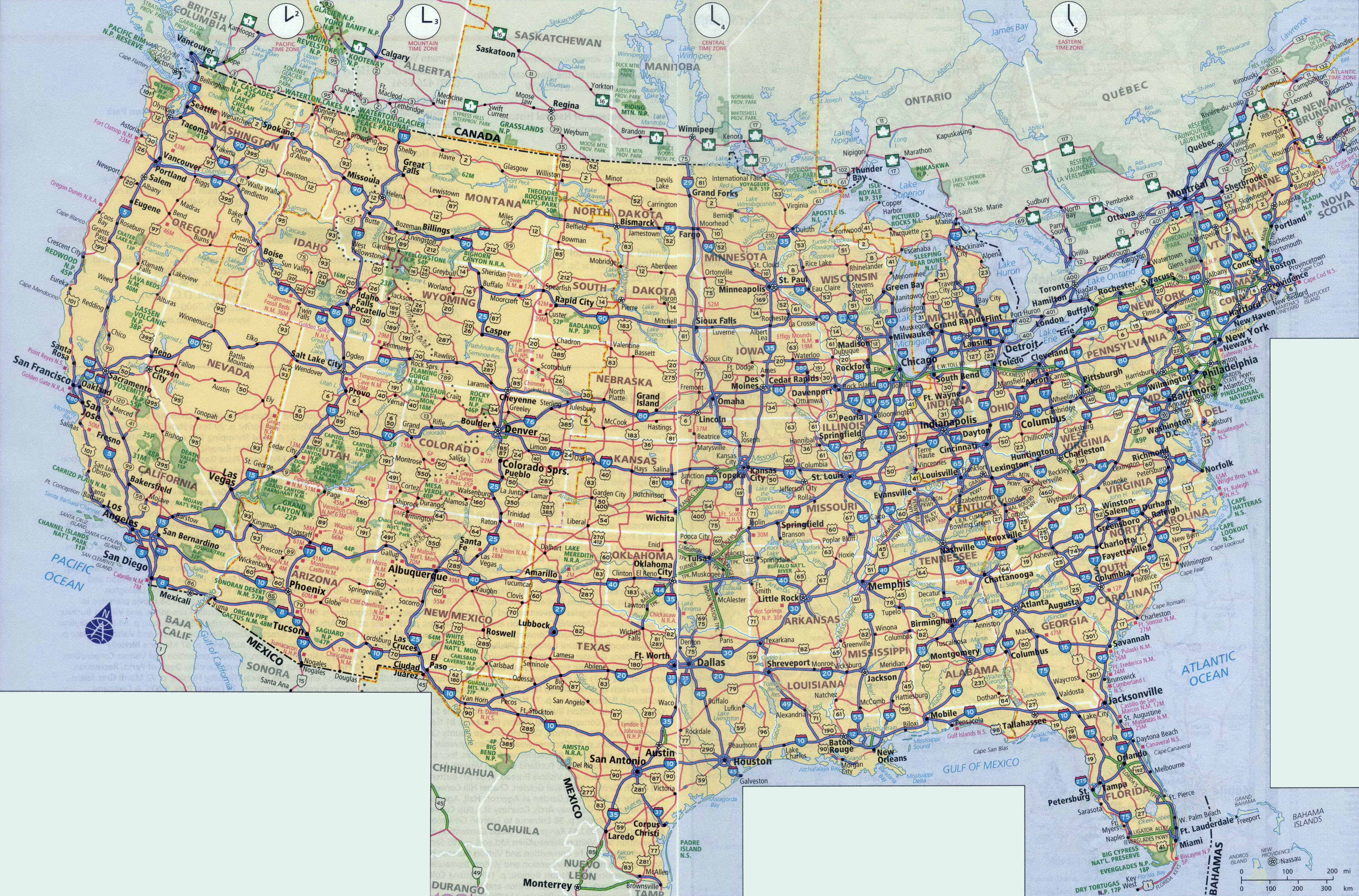
Us Interstate System Map Routes
Us Interstate Highway Map United States Interstate System Highway Map
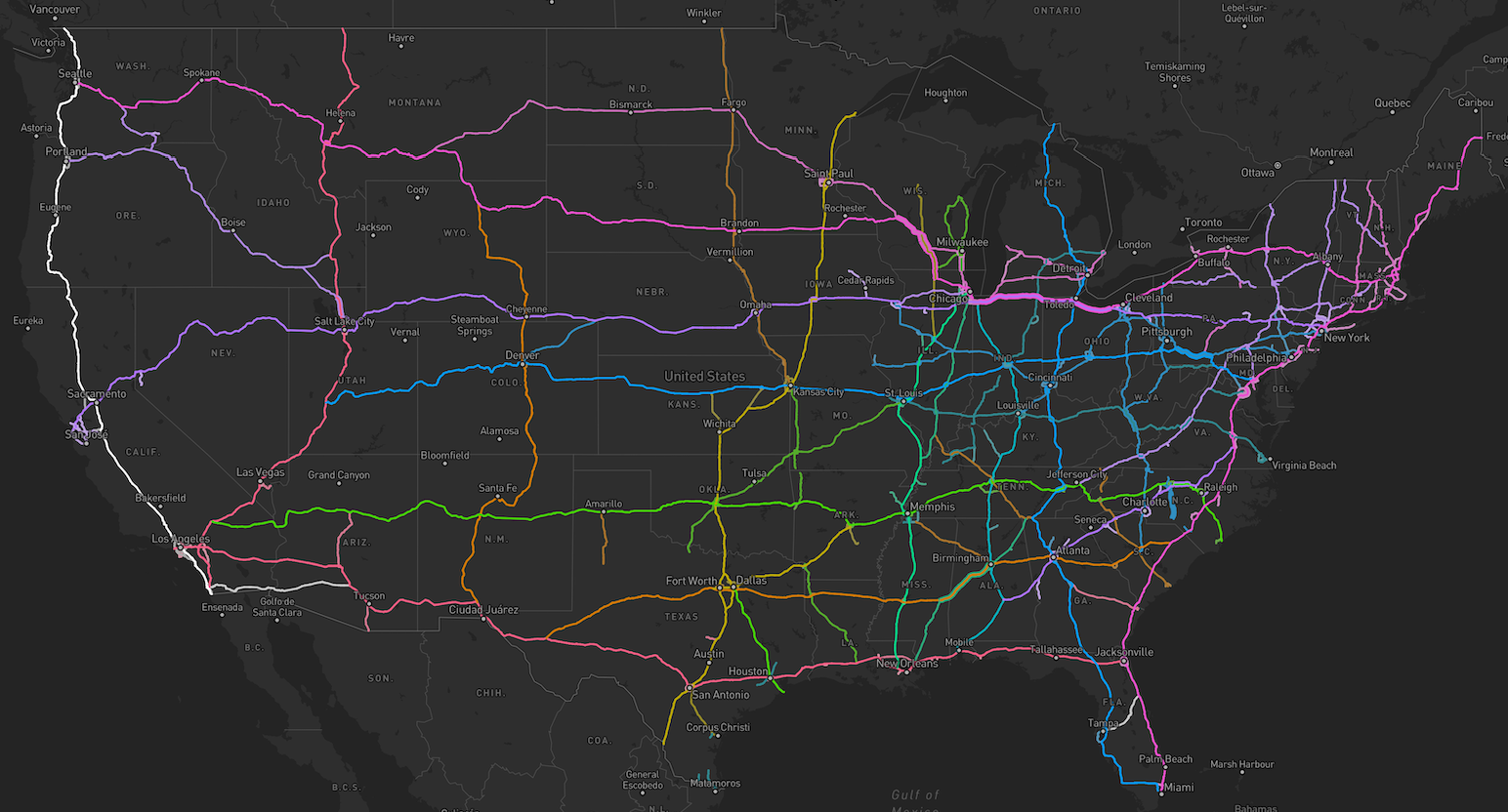
Us Interstate Highway Map United States Interstate System Highway Map
Map Of The United States Highway System | Map Of The United States

Map Of The United States Highway System | Map Of The United States
Usa Road Map | Printable Map Of Us Interstate System - Printable US Maps
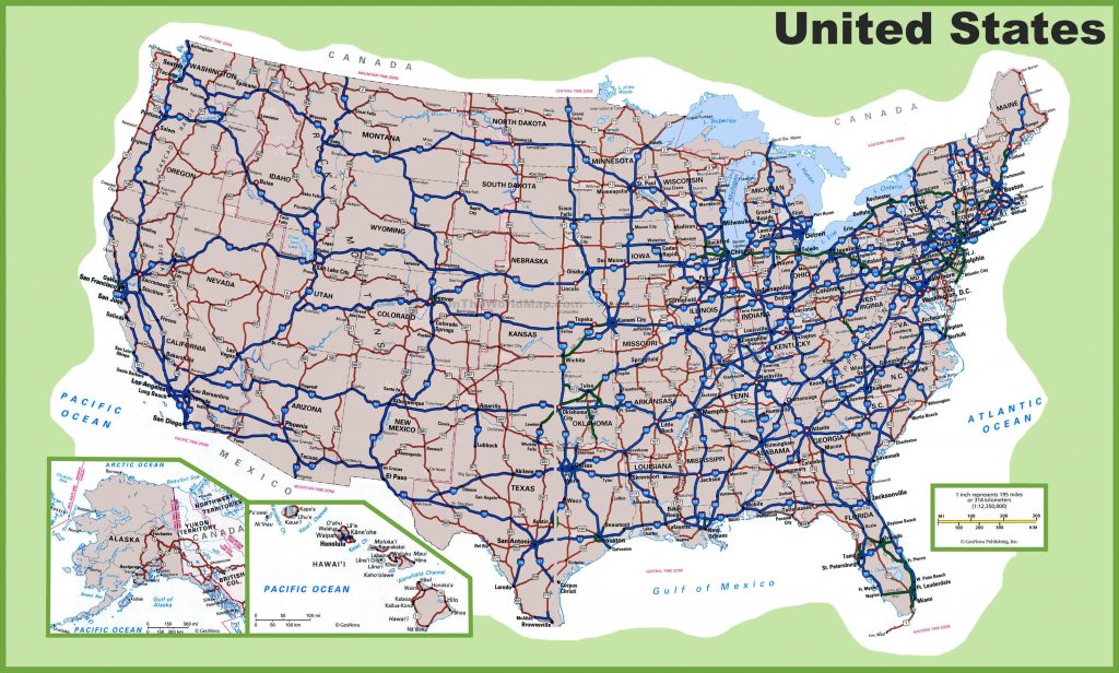
Usa Road Map | Printable Map Of Us Interstate System - Printable US Maps
Us Map With Major Interstates Highways

Us Map With Major Interstates Highways
U.S Interstate System Map Stock Illustration. Illustration Of Brand

U.S Interstate System Map stock illustration. Illustration of brand ...
US Road Map: Interstate Highways In The United States - GIS Geography
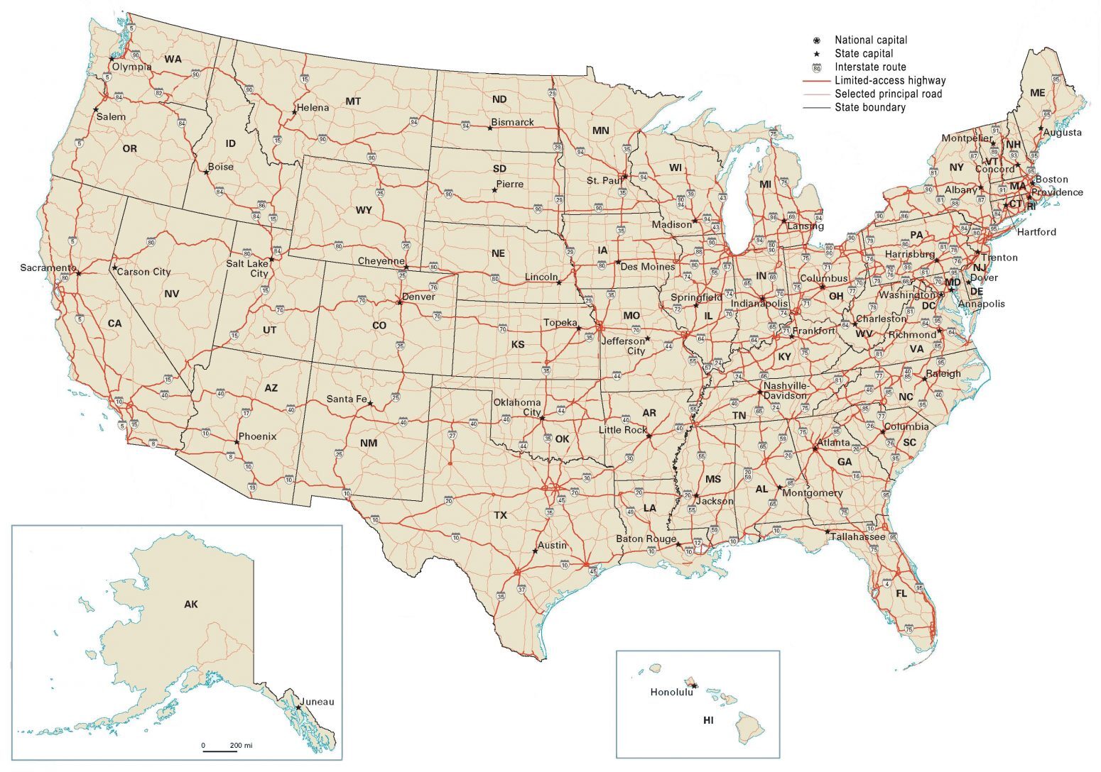
US Road Map: Interstate Highways in the United States - GIS Geography
Map Of The United States Depicting The Interstate Highway System Stock

Map of the United States Depicting the Interstate Highway System Stock ...
Map Of All Interstate Highways – ERNKC

Map Of All Interstate Highways – ERNKC
Us Interstate Highway Map United States Interstate System Highway Map

Us Interstate Highway Map United States Interstate System Highway Map
Us Interstate Highway System Map The Evolving Interstate Highway

Us Interstate Highway System Map The Evolving Interstate Highway
Map Of The United States Highlighting The Interstate Highway System

Map of the United States Highlighting the Interstate Highway System ...
United States Highway Map Pdf Valid Free Printable Us Highway Map
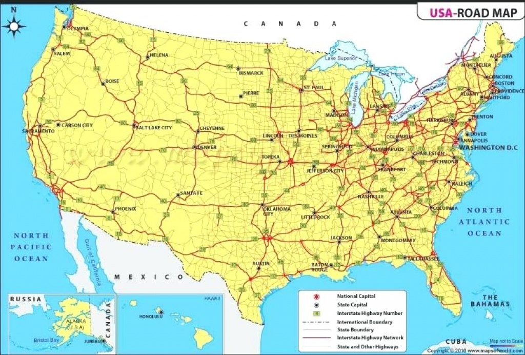
united states highway map pdf valid free printable us highway map ...
Us Interstate Highway Map United States Interstate System Highway Map

Us Interstate Highway Map United States Interstate System Highway Map
